Site Plan to 3D & AI Landscape Rendering
Upload a 2D site plan or master plan to ArkViz AI and get an aerial, isometric or perspective 3D render of the whole site in 15–45 seconds. Or turn a bare plot, garden sketch or outdoor view into a finished landscape with paving, planting and people. No prompts, no modelling, and your layout stays as designed.
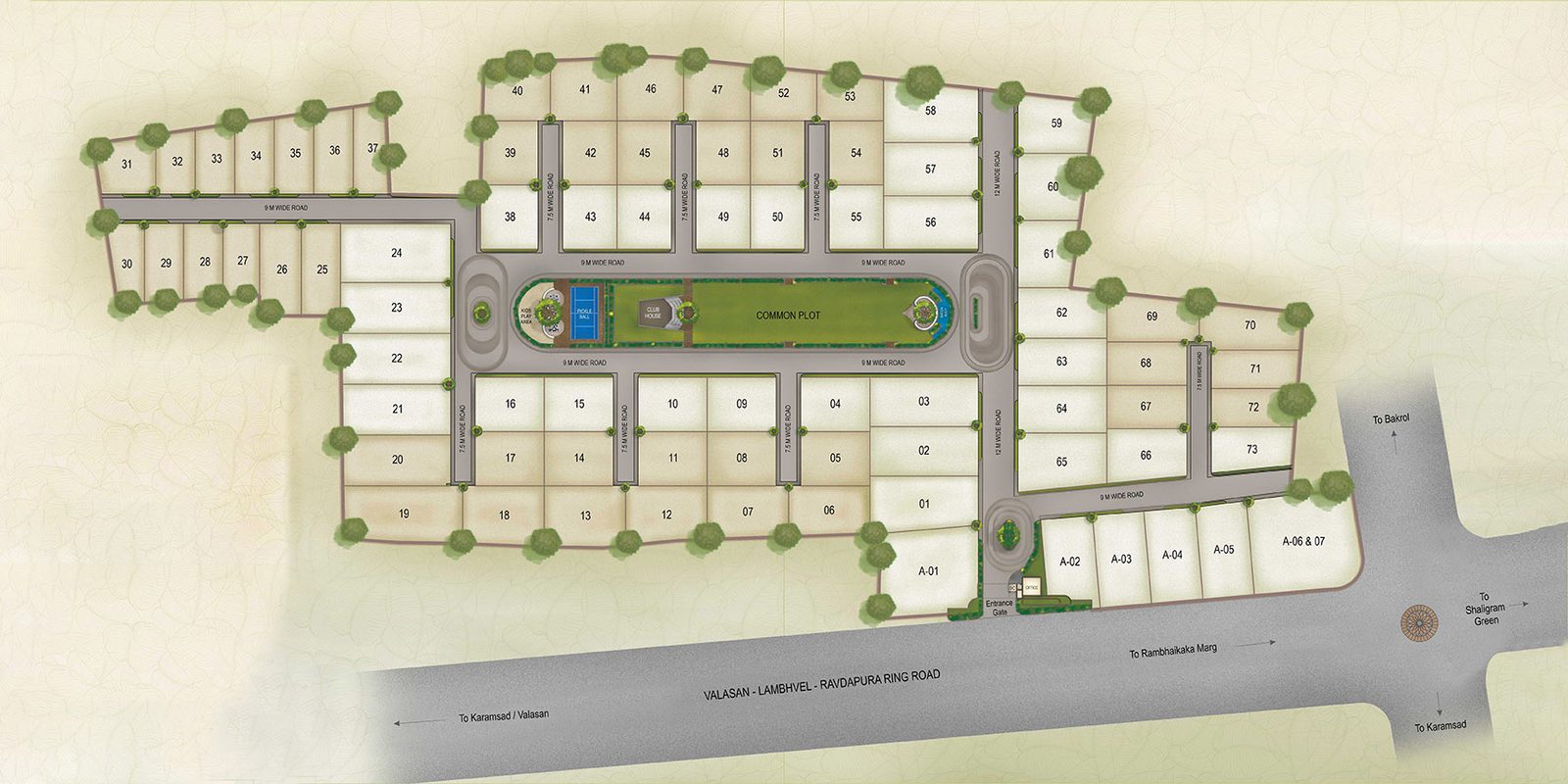
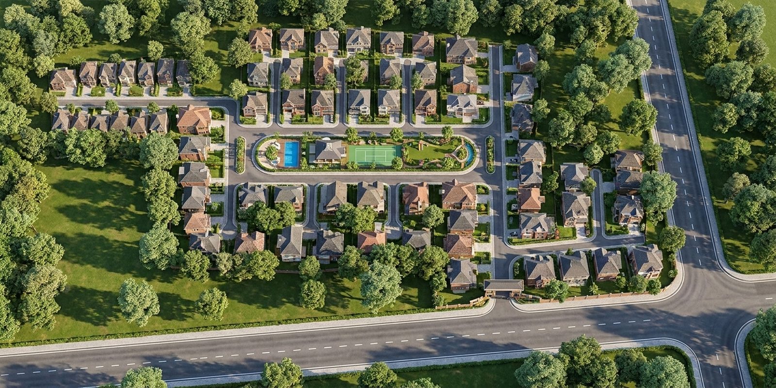
Drag the handle to compare the 2D site plan with the ArkViz AI render.
Quick answer: To turn a 2D site plan into a 3D render with ArkViz AI, open app.arkviz.ai, choose Site Plan, upload the plan (JPG, PNG, WebP or PDF), pick a view type — Aerial Top, Isometric, Perspective or Axonometric — plus style, season and lighting, and click Render. For gardens and outdoor spaces, choose Render Landscape instead and set hardscape and planting density.
Make a site layout easy to understand
Site plans and master plans are clear to architects and planners, but buyers, clients and approval committees often struggle to read roads, plots and green areas from a 2D drawing. Building a full 3D site model for a brochure takes days.
ArkViz AI reads your plan and renders it as a realistic 3D view with buildings, roads, trees and landscaping, so everyone can see the layout at a glance.
Four views
Aerial Top, Isometric, Perspective and Axonometric from the same plan.
Climate-aware
Type your project location for realistic seasons — tropical, dry season or winter only where it fits.
Your layout, kept
Roads, plots and footprints follow your plan. The AI adds realism, not a new layout.
How to render a site plan with ArkViz AI
Export a clean plan
Export your site plan or master plan from AutoCAD or another CAD tool as JPG, PNG or PDF. A clean plan with clear roads, plots and building footprints works best.
Choose Site Plan and upload
Go to app.arkviz.ai, select Site Plan in the Mode list and upload your plan.
Pick view, style, season and lighting
Choose a view type (Aerial Top, Isometric, Perspective or Axonometric), a style, a season and lighting. Optionally add your project location.
Render and refine
Click Render. In 15–45 seconds you get a 3D view of the site. Try another view type, upscale up to 8K (depending on plan), or edit an area with Inpaint & Draw.
Site plan presets in ArkViz AI
| Setting | Options |
|---|---|
| View type | Aerial Top, Isometric, Perspective, Axonometric |
| Style | Photoreal, Watercolor, Illustrated, Sketch, Technical |
| Season | Summer, Autumn, Winter, Spring, Dry Season, Tropical |
| Location (optional) | Your project location, for climate-accurate seasons and light |
| Lighting | Daytime, Golden Hour, Blue Hour, Overcast, Night |
| Also | Aspect ratio and reference images |
AI landscape rendering for gardens and outdoor spaces
Use Render Landscape when the focus is the outdoor space itself — a garden, courtyard, villa lawn, park or amenity area. Upload a landscape sketch, a photo of a bare plot, or a view of your outdoor design, and ArkViz AI adds paving, planting, lighting and people to show the finished landscape.
| Setting | Options |
|---|---|
| Style | Photoreal, Watercolor, Illustrated, Blueprint, Sketch |
| Season | Summer, Autumn, Winter, Spring, Tropical, Desert |
| Location (optional) | Your project location, for climate-accurate planting and seasons |
| Lighting | Daytime, Golden Hour, Blue Hour, Overcast, Night |
| Hardscape | Auto, Stone Pavers, Concrete Pavers, Gravel, Decking, Brick Pathway |
| Planting density | Sparse, Moderate, Lush |
| Camera | Eye Level, Wide Angle, Aerial, Close-Up |
| People & objects | Add People, Blurred People, Add Pets |
Site plan render made with ArkViz AI


Who site plan and landscape rendering is for
- Real estate developers — show township, plotting and society layouts in brochures, hoardings and sales offices.
- Architects and urban planners — present master plans and site strategies in a way clients and committees understand.
- Landscape architects — show garden, courtyard and amenity designs with different paving and planting options.
- Villa and farmhouse clients — see a bare plot as a finished garden before work starts.
Tips for better site plan and landscape renders
- Use a clean plan. Turn off dimension, text and grid layers before exporting so roads and plots are clear.
- Mark green areas. Show lawns, trees and water clearly so the AI places landscaping in the right spots.
- Choose the view for the audience. Aerial Top for layouts, Isometric or Perspective for brochures.
- Add the location. It keeps planting and seasons realistic for your region.
- Try planting density. Sparse, Moderate and Lush show clients how the landscape matures.
What ArkViz AI does — and doesn't — do for site plans
It creates presentation visuals. Use it to explain layouts and landscape ideas. It doesn't produce surveyed drawings, levels or a 3D site model.
It interprets the plan. Where a plan leaves details open, the AI fills them in with realistic buildings, trees and materials. The clearer the plan, the closer the render stays to it.
Need a single building or floor? See the AI exterior rendering, floor plan to 3D and AI interior rendering guides.